
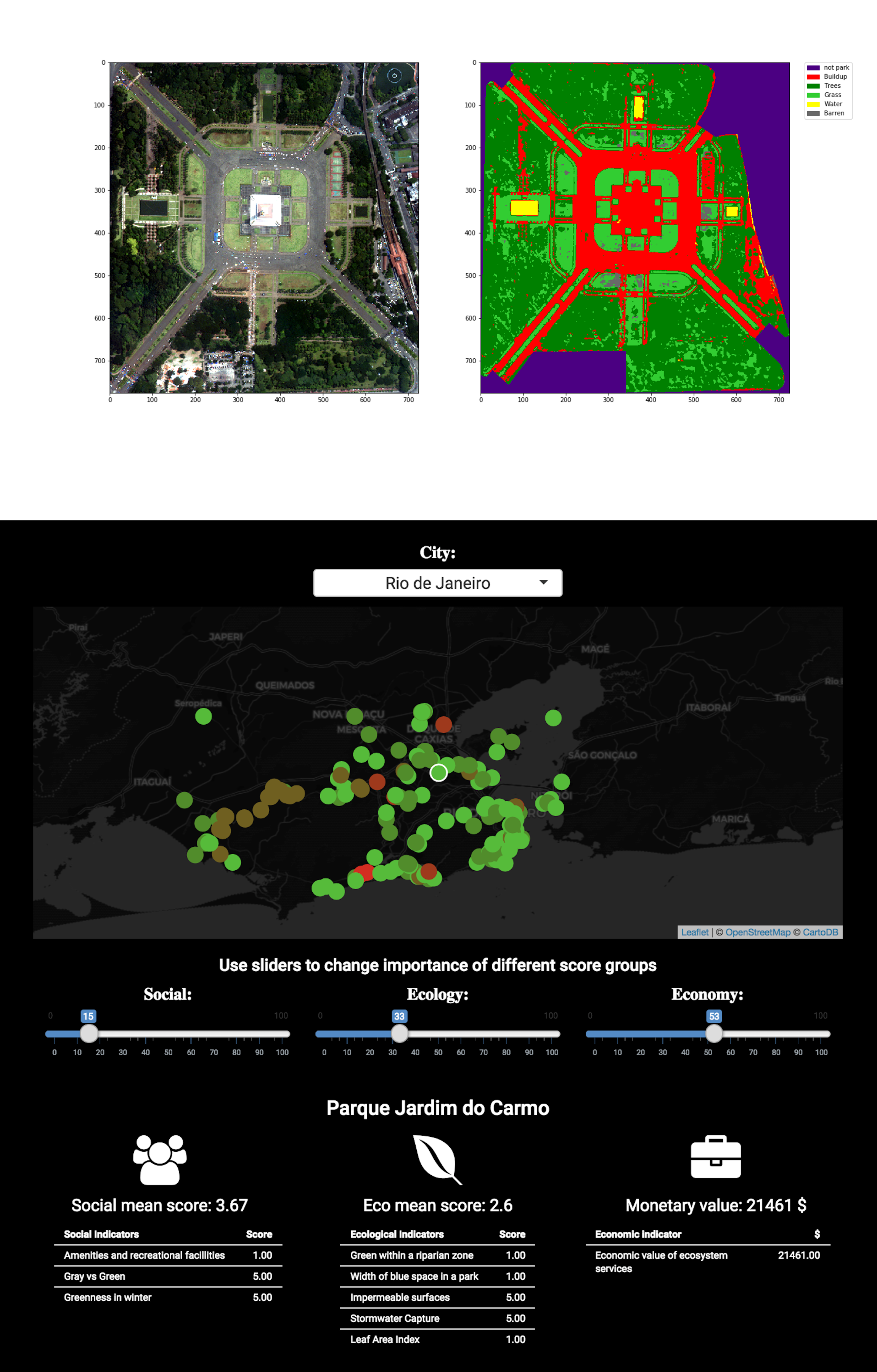
Local governments around the world are working hard to bring nature back into their cities. They require comprehensive and affordable data to measure their success. Green City Watch uses its award-winning urban green space index, AI algorithms and high-resolution satellite imagery to plan, monitor and benchmark greener, healthier and happier urban environments. The process results in Green City Watch’s unique Greenprints, that are both visually meaningful to supporting urban planning discussions but are also digitally interpretable through customary GIS systems and street mapping technologies.
Greenprints are used for urban planning and land policy development. Such is the responsibility of local government. However, institutions and foundations that are investing in or have custody over larger green spaces (e.g. campuses, estates, campgrounds) also benefit from Green City Watch’s platform. Greenprints are used for initial assessments as well as follow-up detailed analysis, time-series longitudinal studies, benchmarking of land development goals, and correlation analysis with related urban planning fields such as public health and traffic monitoring. Clients include local governments in Tbilisi (Georgia) and the 26 largest cities in Indonesia. Green City Watch helps create best practices and guidelines for ‘renaturing’ these new developments.
Nadine Galle: nadine@observanatura.co
Charles Fox, Special Assistant to the Chief Economist for Sustainable Development at World Bank
“The World Bank has a need for objective, verifiable, and internationally comparable data on urban green spaces. Green City Watch (GCW) solves an important analytical and operational problem for us, with a rigorous and defensible methodology. In short, GCW’s process can be deployed worldwide without major adjustment, their chosen data sources are substantially free from bias, and in the case of OpenStreetMap, can be appraised, improved, edited and audited as needed. The GCW methodology is supported by academic references throughout, which lends it considerable credibility. Decision makers and planners can directly make use of GCW’s output. This is an impressive feat, to the extent that the World Bank’s Geospatial Operations Support Team have been working with the GCW team to apply the methodology in operations. In sum, I have been very impressed with the GCW team, and look forward to working with them again.”